
FfARS™
Flood Forecasting Asset Response SystemIn the wake of over $65 billion in coastal damage from Superstorm Sandy (with $29.4 billion of that damage occurring near BEM Systems’ headquarters in New Jersey), BEM played an integral role in the development of risk management strategies for transportation providers in the affected areas. NJ TRANSIT, one of BEM’s most consistent clients, suffered over $400 million in damage to assets, equipment, and infrastructure. Using data collected during multiple surveys before, during, and after the storm, BEM developed a software system that can accurately predict the impact of inundation during extreme weather events such as Superstorm Sandy.
About the System
BEM’s proprietary Flood Forecasting Asset Response System (FfARS™) was designed in partnership with Esri using their ArcGIS platform. It is a web-based storm warning system, designed to assist facility managers and emergency management organizations in the planning and implementation of their flood response plans. Using real-time weather and hydrologic storm forecasts from multiple sources, the FfARS™ can project flood inundation levels and timing up to 96 hours in advance of landfall, based on specific asset locations and elevations. These critical hours before a storm event provide an opportunity for advance flood mitigation measures and asset preservation.
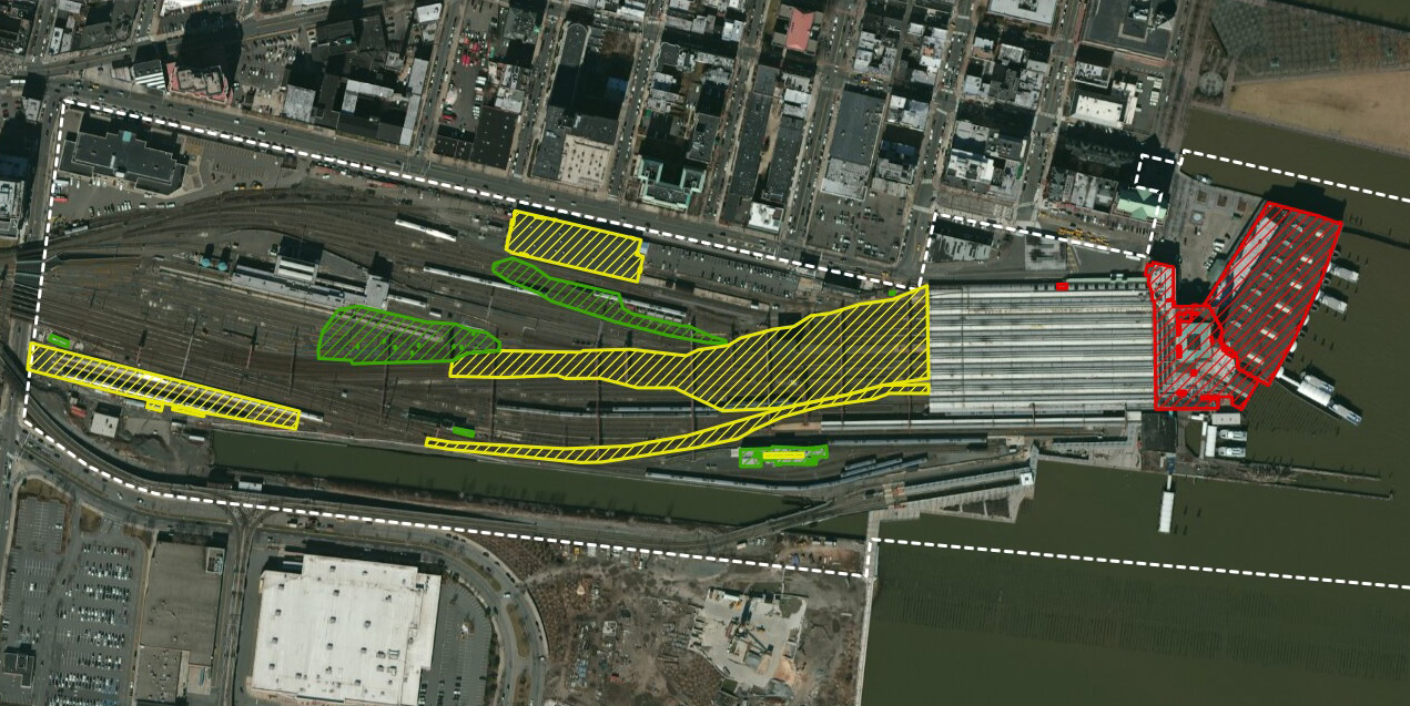
The information is presented through a digital dashboard, allowing users to easily visualize which assets will be impacted, to what extent, and when during the storm. The system also allows users to record when various emergency protective measures were implemented, and to project when operations may be safely restored at the impacted facility.
The FfARS™ is, first and foremost, a data visualization tool that supports critical decision-making in advance of projected storm events. By predicting the impact and extent of upcoming flooding, the associated risks to personel safety and critical infrastructure assets can be mitigated or eliminated entirely.
System Implementation
The FfARS™ was successfully implemented by NJ TRANSIT in September of 2016 as their Coastal Storm Surge Emergency Warning System (CSSEWS). This system is in place at the Hoboken Terminal and Yard in Hoboken, NJ, as well as the Meadows Maintenance Complex (MMC) in Kearny, NJ, both of which suffered severe flooding and asset damage during Superstorm Sandy. NJ TRANSIT has used the system to assist its Police Department, Office of Emergency Management (OEM), operating groups, facility managers, and executive management in the planning and implementation of appropriate Storm Loss Mitigation Plan (SLMP) protective measures.
Key System Functions
-
Calculate accurate, timely, and reliable real-time forecasts of flood elevations and asset impact up to 96 hours in advance
-
Utilize multiple reliable sources of meteorological data to predict the timing, extent, and intensity of storm events with improving accuracy as forecast models are refined, calibrated, and validated
-
Map flood inundation levels over time
-
Provide a decision-making support tool for efficient planning and implementation of actions to protect critical assets
Forecast Data Inputs
-
Storm surge (NOAA hydrographs 84-hour predictions updated every 6 hours, and Stevens Institute NYHOPS 72-hour predictions updated every 6 hours) – projected at 1 foot intervals up to 14 feet
-
Storm track (NOAA predictions for next 120 hours updated every 12 hours and Telvent 120-hour predictions eventually)
-
Wind field predictions (Telvent, NOAA – probability of tropical storm force winds at a location in the next 120 hours)
-
Maximum wind speed of tropical systems (Telvent, NOAA – 12 hour predictions for next 120 hours)
-
LIDAR and/or surveying of critical assets to establish accurate asset elevations
-
Latest Digital Elevation Model (DEM) Topobathy LIDAR