AdTrak™
Outdoor Advertising Tracking and Permit ManagementAdTrak™ is a web-based, GIS-enabled application developed by BEM to manage, track, and document all aspects of Outdoor Advertising (ODA) activities utilizing an intuitive web browser interface to access a secure centralized database system. It is designed to automate the management of ODA requirements for state departments of transportation while ensuring compliance with the Federal Highway Beautification Act (HBA), as well as state and local regulations.
The AdTrak™ system maintains highway advertising sign inventory records, including sign data, location coordinates, and photo documentation; identifies compliance status; generates and issues permits, tracks permit renewals. AdTrak™ also has the capability to manage and permit junkyard and related facilities as required by the HBA. AdTrak™ offers secured, tiered access to contractors and consultants, email ticklers notifying appropriate team members of pending or missed milestones, and robust reporting capabilities for oversight and compliance with federal and state regulations and ordinances.
The centralized data storage architecture allows documents, photos, and maps to be easily uploaded and linked to sign records, resulting in one convenient repository for all ODA artifacts. AdTrak™ is easily customized to address unique agency requirements, and is effortlessly integrated with existing project, financial, GIS, or customer service systems.
AdTrak™ is built on BEM’s industry-leading PAECETrak™ system, utilizing the latest in database template-driven document and permit generation, auditing, reporting, security controls, and configuration flexibility. When installed with the PAECETrak™ system, a fully-integrated, complete, and cost-effective ROW and Outdoor Advertising solution is realized.
Key Features
- Tracks, creates, generates, and stores highway advertising sign permit applications and renewals
- Ensures compliance with the requirements of the HBA, meeting federal agency oversight and audit requirements and avoiding penalties
- Centralizes storage of highway advertising sign inventory records, including relevant sign data, location coordinates, contact information, inspection status, renewal records, appraisals, negotiation, condemnation, notification, compliance status, records of communication, and photo documentation
Typical Workflows
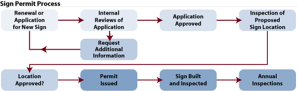
- Create new sign permits
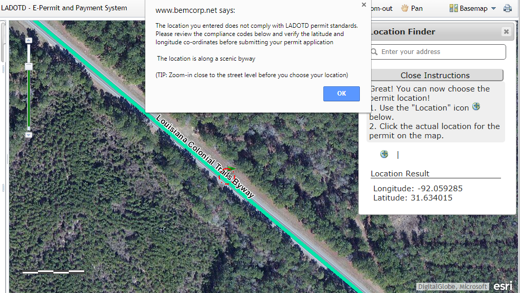
- Allows applicants to create and pay for their own sign applications, and notifies the user when GIS/spatial rules are met or lists the issues found (i.e., too close to existing sign, signs not allowed on scenic byways)
- Allows department staff to review and update applicant information or create applications themselves
- Manage individual and bulk sign permit renewals
- Receive and tracking permitting fees
- Generate permit, inspection, violation, and related documents
The AdTrak™ Dashboard
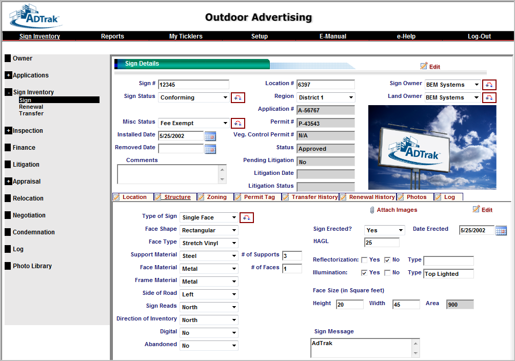
The following screenshot of the AdTrak™ system shows typical sign information, including permit information and status (if permitted) and structure information. Additional capabilities allow the documentation of compliance issues, corrective actions required, and the tracking of resolution verification. The menu on the left indicates the sub-modules that are a part of the AdTrak™ system: Contact Information, Inspections, Renewal (for permitted signs), Appraisal, Negotiations, Condemnation, Notifications, and the Photo Library.
Spatial Rules
As mentioned above, the GIS component of AdTrak™ allows spatial rules to be applied when users create new permit requests. In the screenshot example below, there is a rule that sign permits are not allowed on scenic byways. AdTrak™ tells the user that their location is invalid and does not allow the permit request to be submitted until the location is moved to an acceptable spot.